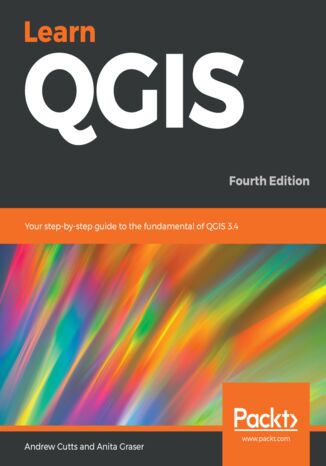
Learn QGIS. Your step-by-step guide to the fundamental of QGIS 3.4 - Fourth Edition Andrew Cutts, Anita Graser


- Autorzy:
- Andrew Cutts, Anita Graser
- Wydawnictwo:
- Packt Publishing
- Ocena:
- Stron:
- 272
- Dostępne formaty:
-
PDFePubMobi
Opis
książki
:
Learn QGIS. Your step-by-step guide to the fundamental of QGIS 3.4 - Fourth Edition
This book will help you get started on your QGIS journey, guiding you to develop your own processing pathway. You will explore the user interface, loading your data, editing, and then creating data. QGIS often surprises new users with its mapping capabilities; you will discover how easily you can style and create your first map. But that’s not all! In the final part of the book, you’ll learn about spatial analysis and the powerful tools in QGIS, and conclude by looking at Python processing options.
By the end of the book, you will have become proficient in geospatial analysis using QGIS and Python.
Wybrane bestsellery
Andrew Cutts, Anita Graser - pozostałe książki
Packt Publishing - inne książki
Dzięki opcji "Druk na żądanie" do sprzedaży wracają tytuły Grupy Helion, które cieszyły sie dużym zainteresowaniem, a których nakład został wyprzedany.
Dla naszych Czytelników wydrukowaliśmy dodatkową pulę egzemplarzy w technice druku cyfrowego.
Co powinieneś wiedzieć o usłudze "Druk na żądanie":
- usługa obejmuje tylko widoczną poniżej listę tytułów, którą na bieżąco aktualizujemy;
- cena książki może być wyższa od początkowej ceny detalicznej, co jest spowodowane kosztami druku cyfrowego (wyższymi niż koszty tradycyjnego druku offsetowego). Obowiązująca cena jest zawsze podawana na stronie WWW książki;
- zawartość książki wraz z dodatkami (płyta CD, DVD) odpowiada jej pierwotnemu wydaniu i jest w pełni komplementarna;
- usługa nie obejmuje książek w kolorze.
Masz pytanie o konkretny tytuł? Napisz do nas: sklep@helion.pl
Książka drukowana


















Oceny i opinie klientów: Learn QGIS. Your step-by-step guide to the fundamental of QGIS 3.4 - Fourth Edition Andrew Cutts, Anita Graser
(0)