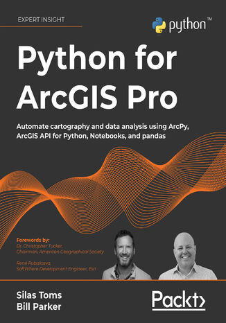
Python for ArcGIS Pro. Automate cartography and data analysis using ArcPy, ArcGIS API for Python, Notebooks, and pandas Silas Toms, Bill Parker, Dr. Christopher Tucker, René Rubalcava


- Autorzy:
- Silas Toms, Bill Parker, Dr. Christopher Tucker, René Rubalcava
- Wydawnictwo:
- Packt Publishing
- Ocena:
- Stron:
- 586
- Dostępne formaty:
-
PDFePub
Opis
książki
:
Python for ArcGIS Pro. Automate cartography and data analysis using ArcPy, ArcGIS API for Python, Notebooks, and pandas
Starting from programming basics and building in complexity, two experienced ArcGIS professionals-turned-Python programmers teach you how to incorporate scripting at each step: automating the production of maps for print, managing data between ArcGIS Pro and ArcGIS Online, creating custom script tools for sharing, and then running data analysis and visualization on top of the ArcGIS geospatial library, all using Python.
You’ll use ArcGIS Pro Notebooks to explore and analyze geospatial data, and write data engineering scripts to manage ongoing data processing and data transfers. This exercise-based book also includes three rich real-world case studies, giving you an opportunity to apply and extend the concepts you studied earlier.
Irrespective of your expertise level with Esri software or the Python language, you’ll benefit from this book’s hands-on approach, which takes you through the major uses of Python for ArcGIS Pro to boost your ArcGIS productivity.
Wybrane bestsellery
Packt Publishing - inne książki
Dzięki opcji "Druk na żądanie" do sprzedaży wracają tytuły Grupy Helion, które cieszyły sie dużym zainteresowaniem, a których nakład został wyprzedany.
Dla naszych Czytelników wydrukowaliśmy dodatkową pulę egzemplarzy w technice druku cyfrowego.
Co powinieneś wiedzieć o usłudze "Druk na żądanie":
- usługa obejmuje tylko widoczną poniżej listę tytułów, którą na bieżąco aktualizujemy;
- cena książki może być wyższa od początkowej ceny detalicznej, co jest spowodowane kosztami druku cyfrowego (wyższymi niż koszty tradycyjnego druku offsetowego). Obowiązująca cena jest zawsze podawana na stronie WWW książki;
- zawartość książki wraz z dodatkami (płyta CD, DVD) odpowiada jej pierwotnemu wydaniu i jest w pełni komplementarna;
- usługa nie obejmuje książek w kolorze.
Masz pytanie o konkretny tytuł? Napisz do nas: sklep@helion.pl
Książka drukowana












Oceny i opinie klientów: Python for ArcGIS Pro. Automate cartography and data analysis using ArcPy, ArcGIS API for Python, Notebooks, and pandas Silas Toms, Bill Parker, Dr. Christopher Tucker, René Rubalcava
(0)