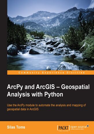
ArcPy and ArcGIS - Geospatial Analysis with Python. Use the ArcPy module to automate the analysis and mapping of geospatial data in ArcGIS Silas Toms, Silas Toms


- Autorzy:
- Silas Toms, Silas Toms
- Wydawnictwo:
- Packt Publishing
- Ocena:
- Stron:
- 224
- Dostępne formaty:
-
PDFePubMobi
Opis
książki
:
ArcPy and ArcGIS - Geospatial Analysis with Python. Use the ArcPy module to automate the analysis and mapping of geospatial data in ArcGIS
Wybrane bestsellery
Packt Publishing - inne książki
Dzięki opcji "Druk na żądanie" do sprzedaży wracają tytuły Grupy Helion, które cieszyły sie dużym zainteresowaniem, a których nakład został wyprzedany.
Dla naszych Czytelników wydrukowaliśmy dodatkową pulę egzemplarzy w technice druku cyfrowego.
Co powinieneś wiedzieć o usłudze "Druk na żądanie":
- usługa obejmuje tylko widoczną poniżej listę tytułów, którą na bieżąco aktualizujemy;
- cena książki może być wyższa od początkowej ceny detalicznej, co jest spowodowane kosztami druku cyfrowego (wyższymi niż koszty tradycyjnego druku offsetowego). Obowiązująca cena jest zawsze podawana na stronie WWW książki;
- zawartość książki wraz z dodatkami (płyta CD, DVD) odpowiada jej pierwotnemu wydaniu i jest w pełni komplementarna;
- usługa nie obejmuje książek w kolorze.
Masz pytanie o konkretny tytuł? Napisz do nas: sklep@helion.pl
Książka drukowana










Oceny i opinie klientów: ArcPy and ArcGIS - Geospatial Analysis with Python. Use the ArcPy module to automate the analysis and mapping of geospatial data in ArcGIS Silas Toms, Silas Toms
(0)