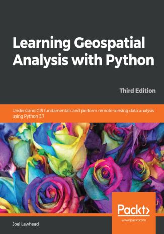
Learning Geospatial Analysis with Python. Understand GIS fundamentals and perform remote sensing data analysis using Python 3.7 - Third Edition Joel Lawhead


- Autor:
- Joel Lawhead
- Wydawnictwo:
- Packt Publishing
- Ocena:
- Stron:
- 456
- Dostępne formaty:
-
PDFePubMobi
Opis
książki
:
Learning Geospatial Analysis with Python. Understand GIS fundamentals and perform remote sensing data analysis using Python 3.7 - Third Edition
This book will take you through GIS techniques, geodatabases, geospatial raster data, and much more using the latest built-in tools and libraries in Python 3.7. You'll learn everything you need to know about using software packages or APIs and generic algorithms that can be used for different situations. Furthermore, you'll learn how to apply simple Python GIS geospatial processes to a variety of problems, and work with remote sensing data.
By the end of the book, you'll be able to build a generic corporate system, which can be implemented in any organization to manage customer support requests and field support personnel.
Wybrane bestsellery
Joel Lawhead - pozostałe książki
Packt Publishing - inne książki
Dzięki opcji "Druk na żądanie" do sprzedaży wracają tytuły Grupy Helion, które cieszyły sie dużym zainteresowaniem, a których nakład został wyprzedany.
Dla naszych Czytelników wydrukowaliśmy dodatkową pulę egzemplarzy w technice druku cyfrowego.
Co powinieneś wiedzieć o usłudze "Druk na żądanie":
- usługa obejmuje tylko widoczną poniżej listę tytułów, którą na bieżąco aktualizujemy;
- cena książki może być wyższa od początkowej ceny detalicznej, co jest spowodowane kosztami druku cyfrowego (wyższymi niż koszty tradycyjnego druku offsetowego). Obowiązująca cena jest zawsze podawana na stronie WWW książki;
- zawartość książki wraz z dodatkami (płyta CD, DVD) odpowiada jej pierwotnemu wydaniu i jest w pełni komplementarna;
- usługa nie obejmuje książek w kolorze.
Masz pytanie o konkretny tytuł? Napisz do nas: sklep@helion.pl
Książka drukowana








Oceny i opinie klientów: Learning Geospatial Analysis with Python. Understand GIS fundamentals and perform remote sensing data analysis using Python 3.7 - Third Edition Joel Lawhead
(0)