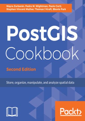
PostGIS Cookbook. Store, organize, manipulate, and analyze spatial data - Second Edition Pedro Wightman, Bborie Park, Stephen Vincent Mather, Thomas Kraft, Mayra Zurbarán


- Autorzy:
- Pedro Wightman, Bborie Park, Stephen Vincent Mather, Thomas Kraft, Mayra Zurbarán
- Wydawnictwo:
- Packt Publishing
- Ocena:
- Stron:
- 584
- Dostępne formaty:
-
PDFePubMobi
Opis
książki
:
PostGIS Cookbook. Store, organize, manipulate, and analyze spatial data - Second Edition
If you want to explore the complete range of PostGIS techniques and expose related extensions, then this book is for you.
This book is a comprehensive guide to PostGIS tools and concepts which are required to manage, manipulate, and analyze spatial data in PostGIS. It covers key spatial data manipulation tasks, explaining not only how each task is performed, but also why. It provides practical guidance allowing you to safely take advantage of the advanced technology in PostGIS in order to simplify your spatial database administration tasks. Furthermore, you will learn to take advantage of basic and advanced vector, raster, and routing approaches along with the concepts of data maintenance, optimization, and performance, and will help you to integrate these into a large ecosystem of desktop and web tools.
By the end, you will be armed with all the tools and instructions you need to both manage the spatial database system and make better decisions as your project's requirements evolve.
Wybrane bestsellery
Packt Publishing - inne książki
Dzięki opcji "Druk na żądanie" do sprzedaży wracają tytuły Grupy Helion, które cieszyły sie dużym zainteresowaniem, a których nakład został wyprzedany.
Dla naszych Czytelników wydrukowaliśmy dodatkową pulę egzemplarzy w technice druku cyfrowego.
Co powinieneś wiedzieć o usłudze "Druk na żądanie":
- usługa obejmuje tylko widoczną poniżej listę tytułów, którą na bieżąco aktualizujemy;
- cena książki może być wyższa od początkowej ceny detalicznej, co jest spowodowane kosztami druku cyfrowego (wyższymi niż koszty tradycyjnego druku offsetowego). Obowiązująca cena jest zawsze podawana na stronie WWW książki;
- zawartość książki wraz z dodatkami (płyta CD, DVD) odpowiada jej pierwotnemu wydaniu i jest w pełni komplementarna;
- usługa nie obejmuje książek w kolorze.
Masz pytanie o konkretny tytuł? Napisz do nas: sklep@helion.pl
Książka drukowana











Oceny i opinie klientów: PostGIS Cookbook. Store, organize, manipulate, and analyze spatial data - Second Edition Pedro Wightman, Bborie Park, Stephen Vincent Mather, Thomas Kraft, Mayra Zurbarán
(0)