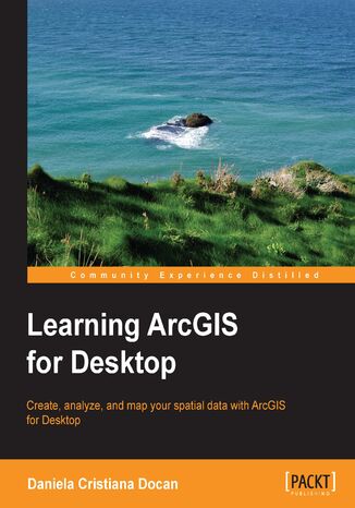
Learning ArcGIS for Desktop. Create, analyze, and map your spatial data with ArcGIS for Desktop Daniela C Docan


- Autor:
- Daniela C Docan
- Wydawnictwo:
- Packt Publishing
- Ocena:
- Stron:
- 344
- Dostępne formaty:
-
PDFePubMobi
Opis
książki
:
Learning ArcGIS for Desktop. Create, analyze, and map your spatial data with ArcGIS for Desktop
The first five chapters cover the basic concepts of working with the File Geodatabase, as well as editing and symbolizing geospatial data. Then, the book focuses on planning and performing spatial analysis on vector and raster data using the geoprocessing and modeling tools. Finally, the basic principles of cartography design will be used to create a quality map that presents the information that resulted from the spatial analysis previously performed. To keep you learning throughout the chapters, all exercises have partial and final results stored in the dataset that accompanies the book. Finally, the book offers more than it promises by using the ArcGIS Online component in the tutorials as source of background data and for results sharing
Wybrane bestsellery
Packt Publishing - inne książki
Dzięki opcji "Druk na żądanie" do sprzedaży wracają tytuły Grupy Helion, które cieszyły sie dużym zainteresowaniem, a których nakład został wyprzedany.
Dla naszych Czytelników wydrukowaliśmy dodatkową pulę egzemplarzy w technice druku cyfrowego.
Co powinieneś wiedzieć o usłudze "Druk na żądanie":
- usługa obejmuje tylko widoczną poniżej listę tytułów, którą na bieżąco aktualizujemy;
- cena książki może być wyższa od początkowej ceny detalicznej, co jest spowodowane kosztami druku cyfrowego (wyższymi niż koszty tradycyjnego druku offsetowego). Obowiązująca cena jest zawsze podawana na stronie WWW książki;
- zawartość książki wraz z dodatkami (płyta CD, DVD) odpowiada jej pierwotnemu wydaniu i jest w pełni komplementarna;
- usługa nie obejmuje książek w kolorze.
Masz pytanie o konkretny tytuł? Napisz do nas: sklep@helion.pl
Książka drukowana





















Oceny i opinie klientów: Learning ArcGIS for Desktop. Create, analyze, and map your spatial data with ArcGIS for Desktop Daniela C Docan
(0)