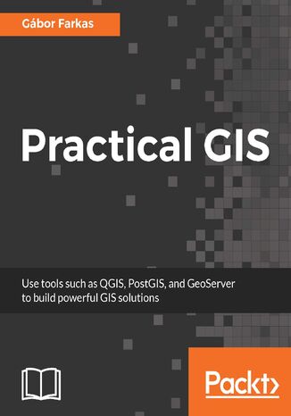
Practical GIS. Learn novice to advanced topics such as QGIS, Spatial data analysis, and more Gábor Farkas


- Autor:
- Gábor Farkas
- Wydawnictwo:
- Packt Publishing
- Ocena:
- Stron:
- 428
- Dostępne formaty:
-
PDFePubMobi
Opis
książki
:
Practical GIS. Learn novice to advanced topics such as QGIS, Spatial data analysis, and more
We’ll start by setting up the environment for the tools we use in the book. Then you will learn how to work with QGIS in order to generate useful spatial data. You will get to know the basics of queries, data management, and geoprocessing.
After that, you will start to practice your knowledge on real-world examples. We will solve various types of geospatial analyses with various methods. We will start with basic GIS problems by imitating the work of an enthusiastic real estate agent, and continue with more advanced, but typical tasks by solving a decision problem.
Finally, you will find out how to publish your data (and results) on the web. We will publish our data with QGIS Server and GeoServer, and create a basic web map with the API of the lightweight Leaflet web mapping library.
Wybrane bestsellery
Packt Publishing - inne książki
Dzięki opcji "Druk na żądanie" do sprzedaży wracają tytuły Grupy Helion, które cieszyły sie dużym zainteresowaniem, a których nakład został wyprzedany.
Dla naszych Czytelników wydrukowaliśmy dodatkową pulę egzemplarzy w technice druku cyfrowego.
Co powinieneś wiedzieć o usłudze "Druk na żądanie":
- usługa obejmuje tylko widoczną poniżej listę tytułów, którą na bieżąco aktualizujemy;
- cena książki może być wyższa od początkowej ceny detalicznej, co jest spowodowane kosztami druku cyfrowego (wyższymi niż koszty tradycyjnego druku offsetowego). Obowiązująca cena jest zawsze podawana na stronie WWW książki;
- zawartość książki wraz z dodatkami (płyta CD, DVD) odpowiada jej pierwotnemu wydaniu i jest w pełni komplementarna;
- usługa nie obejmuje książek w kolorze.
Masz pytanie o konkretny tytuł? Napisz do nas: sklep@helion.pl
Książka drukowana









Oceny i opinie klientów: Practical GIS. Learn novice to advanced topics such as QGIS, Spatial data analysis, and more Gábor Farkas
(0)