×
Dodano do koszyka:
Pozycja znajduje się w koszyku, zwiększono ilość tej pozycji:
Zakupiłeś już tę pozycję:
Książkę możesz pobrać z biblioteki w panelu użytkownika
Pozycja znajduje się w koszyku
Przejdź do koszyka

Zawartość koszyka

ODBIERZ TWÓJ BONUS :: »

Instant OpenLayers Starter. Web Mapping made simple and fast!

(ebook) (audiobook) (audiobook) Książka w języku angielskim
Instant OpenLayers Starter. Web Mapping made simple and fast! Alessio Di Lorenzo, Giovanni Allegri - okladka książki
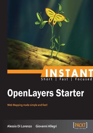
Instant OpenLayers Starter. Web Mapping made simple and fast! Alessio Di Lorenzo, Giovanni Allegri - okladka książki

Instant OpenLayers Starter. Web Mapping made simple and fast! Alessio Di Lorenzo, Giovanni Allegri - audiobook MP3

Instant OpenLayers Starter. Web Mapping made simple and fast! Alessio Di Lorenzo, Giovanni Allegri - audiobook CD

Ocena:
Bądź pierwszym, który oceni tę książkę
Stron:
58
Dostępne formaty:
     PDF
     ePub
     Mobi
OpenLayers is an open source JavaScript web mapping library distinguished from other alternatives, like Leaflet or Google Maps APIs, because of its huge set of components. Having being on the scene for a long time, users can benefit from a large set of resources and documentations, and a wide and actively supportive community.Instant OpenLayers Starter gives you the possibility to produce your first “real” web map without being an experienced programmer or a GIS specialist. It provides you with an overview of the most popular vector and raster data formats used to share spatial information on the Web. By the end of the book you will be able to amaze your boss with a brand new web map and a bag of skills to give life to your geodata.Instant OpenLayers Starter guides you through a fast and effective journey of web mapping, to discover how easy it is to put maps in your web projects, from simple base maps to interactive geo mash-ups, Google Maps, OpenStreetmap, GeoRSS, Panoramio, and your data. Starting with a lot of geo-information sources and a powerful library, we will explore how to manage maps inside web pages using basic third-party base maps to the overlay of re-projected vector data, going through styling thematic data and data interaction.

Wybrane bestsellery

O autorach książki

Alessio Di Lorenzo is a Marine Biologist and an MSc in Geographical Information Systems and Remote Sensing. Now he is living in Pescara, Italy, the place where he was born in October 1979. One fine day, looking for suitable tools to represent and analyze the environmental phenomena, he discovered GIS and decided that it was worthwhile to investigate the topic. By mixing his personal interest in computer science, open source software, and programming languages with the spatial knowledge, he has concentrated more and more on Web Mapping and Web GIS. Nowadays, he works as a consultant and trainer for local and central governments and various organizations. Most of his experience concerns the use of geospatial and web technologies to study and manage data from emergency and monitoring plans in the environmental, veterinary, and public health fields. He is author and co-author of articles concerning GIS for various scientific papers and for the TANTO blog. When not having fun with maps and connected stuff, he likes to spend his time swimming and riding his mountain bike or his motorcycle!
Giovanni Allegri has a degree in Earth Science from the Centre for Geotechnologies (CGT) at the University of Siena (Italy). He works as a GIS freelance consultant and analyst for public agencies and private companies. His work ranges from Spatial data modeling and GIS analysis, to GIS/WebGIS software development and cartography._x000D_ _x000D_ He runs courses on Spatial DB design and management, GIS analysis and WebGIS development, based mainly on free and open source technologies. _x000D_

Packt Publishing - inne książki

Zamknij

Przenieś na półkę

Proszę czekać...
ajax-loader

Zamknij

Wybierz metodę płatności

Zamknij Pobierz aplikację mobilną Ebookpoint