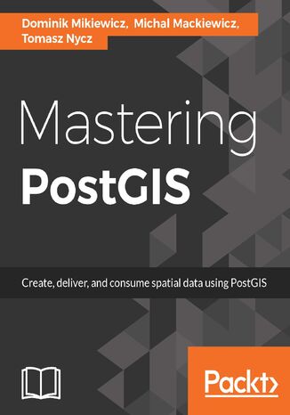
Mastering PostGIS. Modern ways to create, analyze, and implement spatial data


- Wydawnictwo:
- Packt Publishing
- Ocena:
- Stron:
- 328
- Dostępne formaty:
-
PDFePubMobi
Opis
książki
:
Mastering PostGIS. Modern ways to create, analyze, and implement spatial data
The book begins with an overview of the key concepts related to spatial database systems and how it applies to Spatial RMDS. You will learn to load different formats into your Postgres instance, investigate the spatial nature of your raster data, and finally export it using built-in functionalities or 3th party tools for backup or representational purposes.
Through the course of this book, you will be presented with many examples on how to interact with the database using JavaScript and Node.js. Sample web-based applications interacting with backend PostGIS will also be presented throughout the book, so you can get comfortable with the modern ways of consuming and modifying your spatial data.
Wybrane bestsellery
Packt Publishing - inne książki
Dzięki opcji "Druk na żądanie" do sprzedaży wracają tytuły Grupy Helion, które cieszyły sie dużym zainteresowaniem, a których nakład został wyprzedany.
Dla naszych Czytelników wydrukowaliśmy dodatkową pulę egzemplarzy w technice druku cyfrowego.
Co powinieneś wiedzieć o usłudze "Druk na żądanie":
- usługa obejmuje tylko widoczną poniżej listę tytułów, którą na bieżąco aktualizujemy;
- cena książki może być wyższa od początkowej ceny detalicznej, co jest spowodowane kosztami druku cyfrowego (wyższymi niż koszty tradycyjnego druku offsetowego). Obowiązująca cena jest zawsze podawana na stronie WWW książki;
- zawartość książki wraz z dodatkami (płyta CD, DVD) odpowiada jej pierwotnemu wydaniu i jest w pełni komplementarna;
- usługa nie obejmuje książek w kolorze.
Masz pytanie o konkretny tytuł? Napisz do nas:
Książka drukowana













Oceny i opinie klientów: Mastering PostGIS. Modern ways to create, analyze, and implement spatial data Dominik Mikiewicz, Michal Mackiewicz, Tomasz Nycz (0) Weryfikacja opinii następuję na podstawie historii zamówień na koncie Użytkownika umieszczającego opinię. Użytkownik mógł otrzymać punkty za opublikowanie opinii uprawniające do uzyskania rabatu w ramach Programu Punktowego.